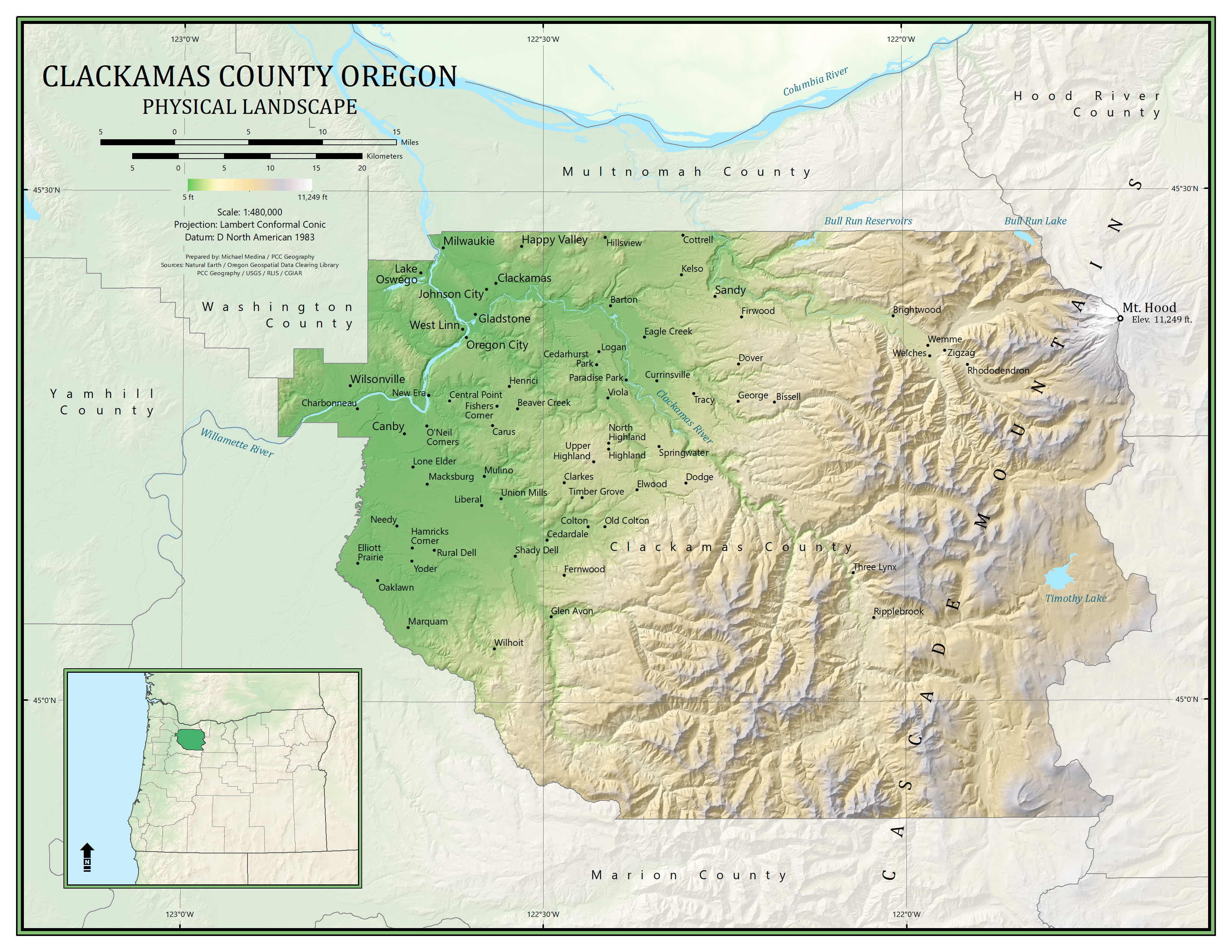
Physical map with custom hypsometric tint. Created in ESRI ArcMap and Adobe Photoshop
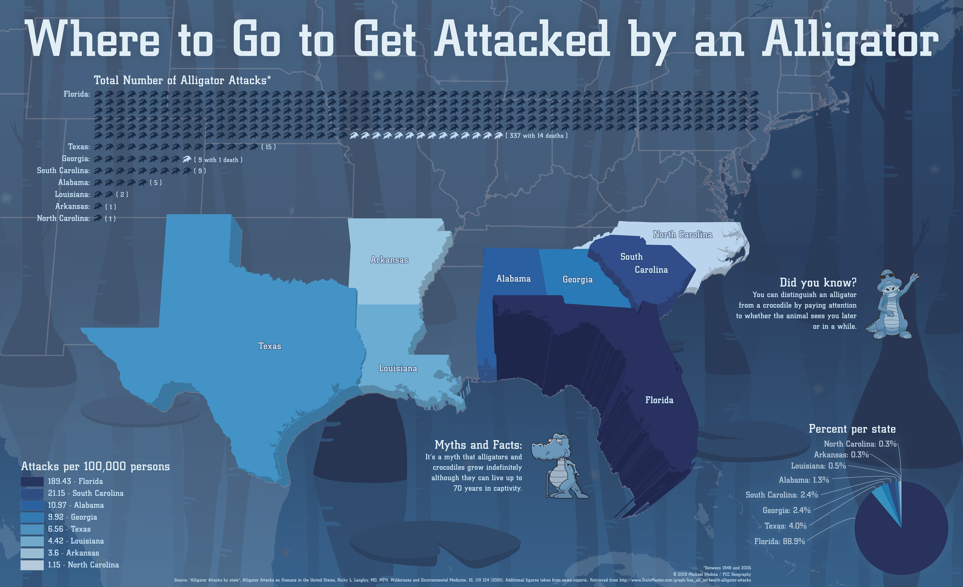
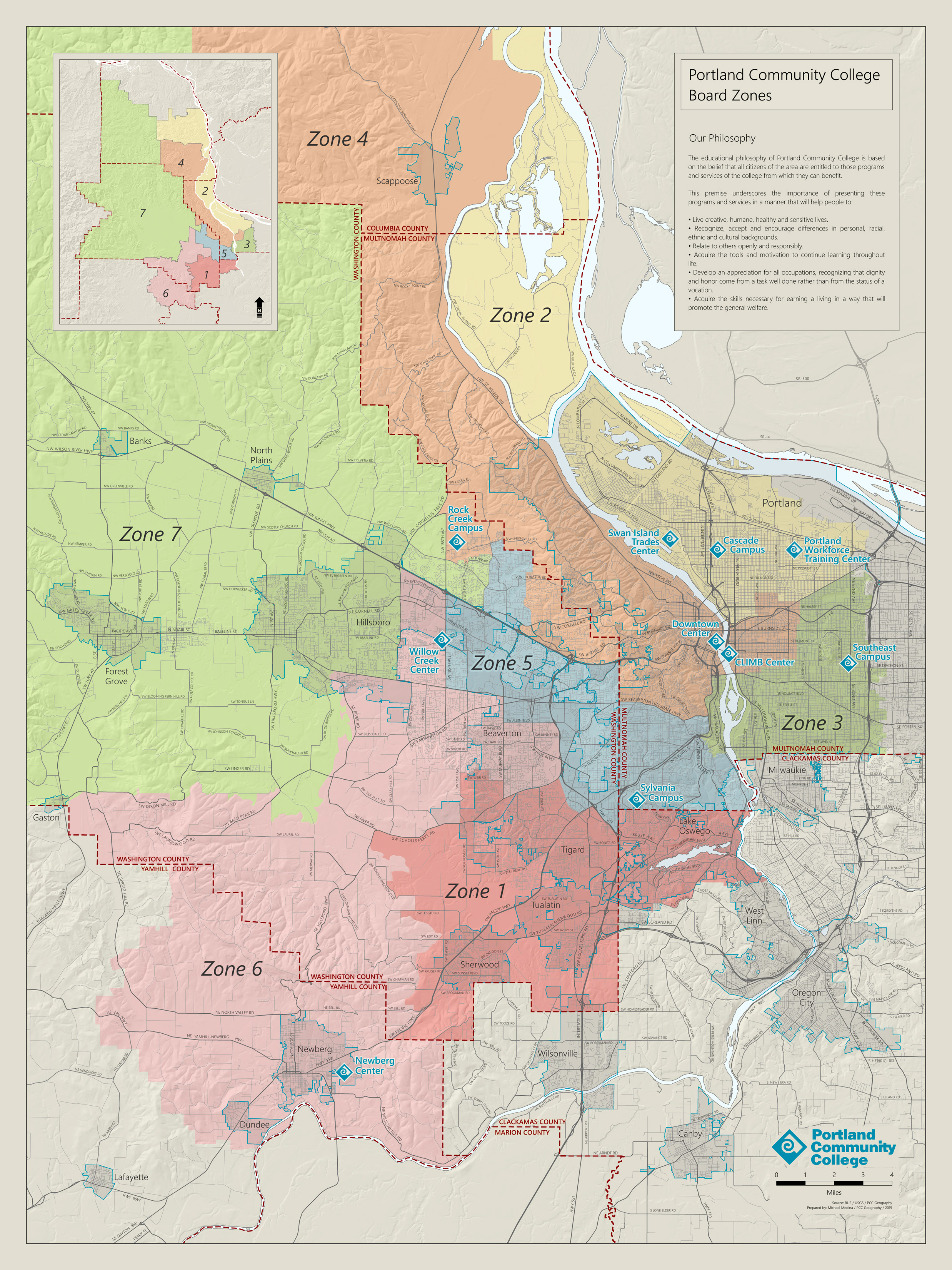
Infographic created in ESRI ArcGIS Pro, Adobe Illustrator, and Adobe Photoshop
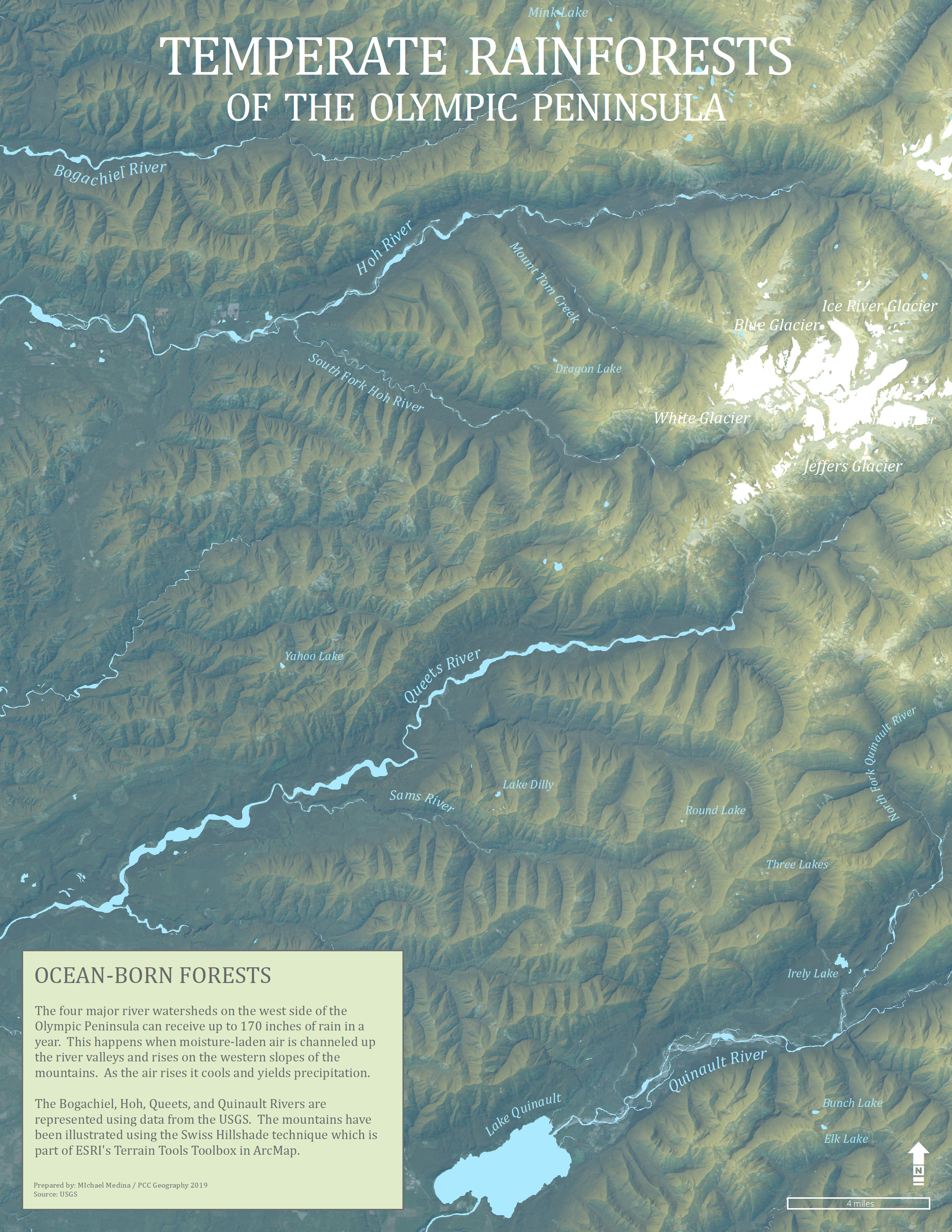
Swiss Hillshade using ESRI ArcMap Terrain Tools
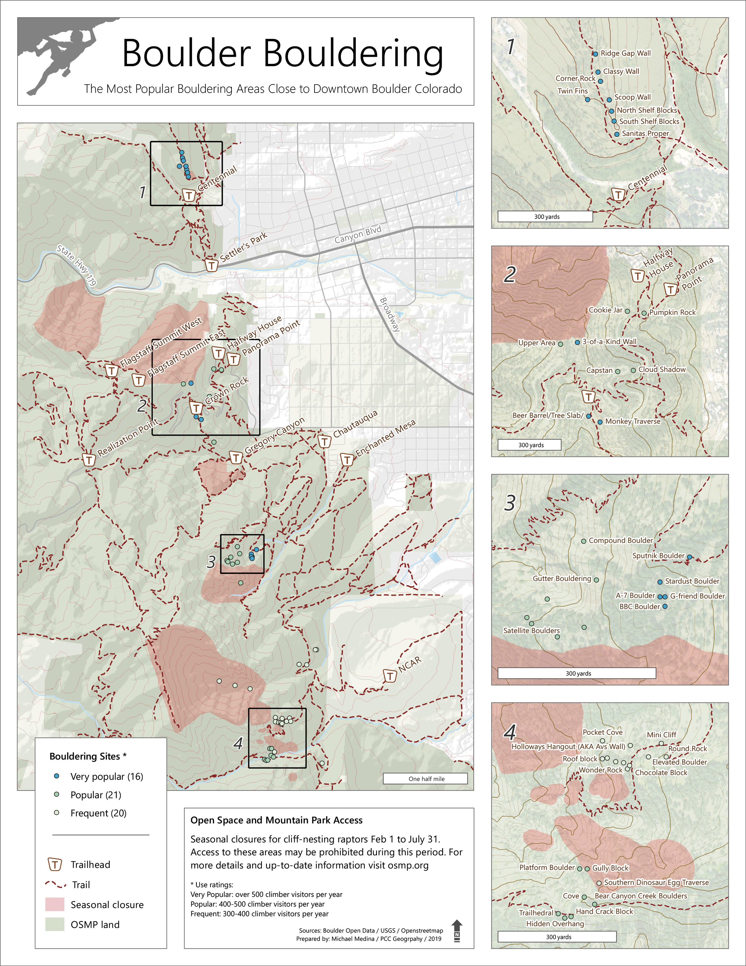
Multiple layers with various opacities. Created in ESRI ArcMap
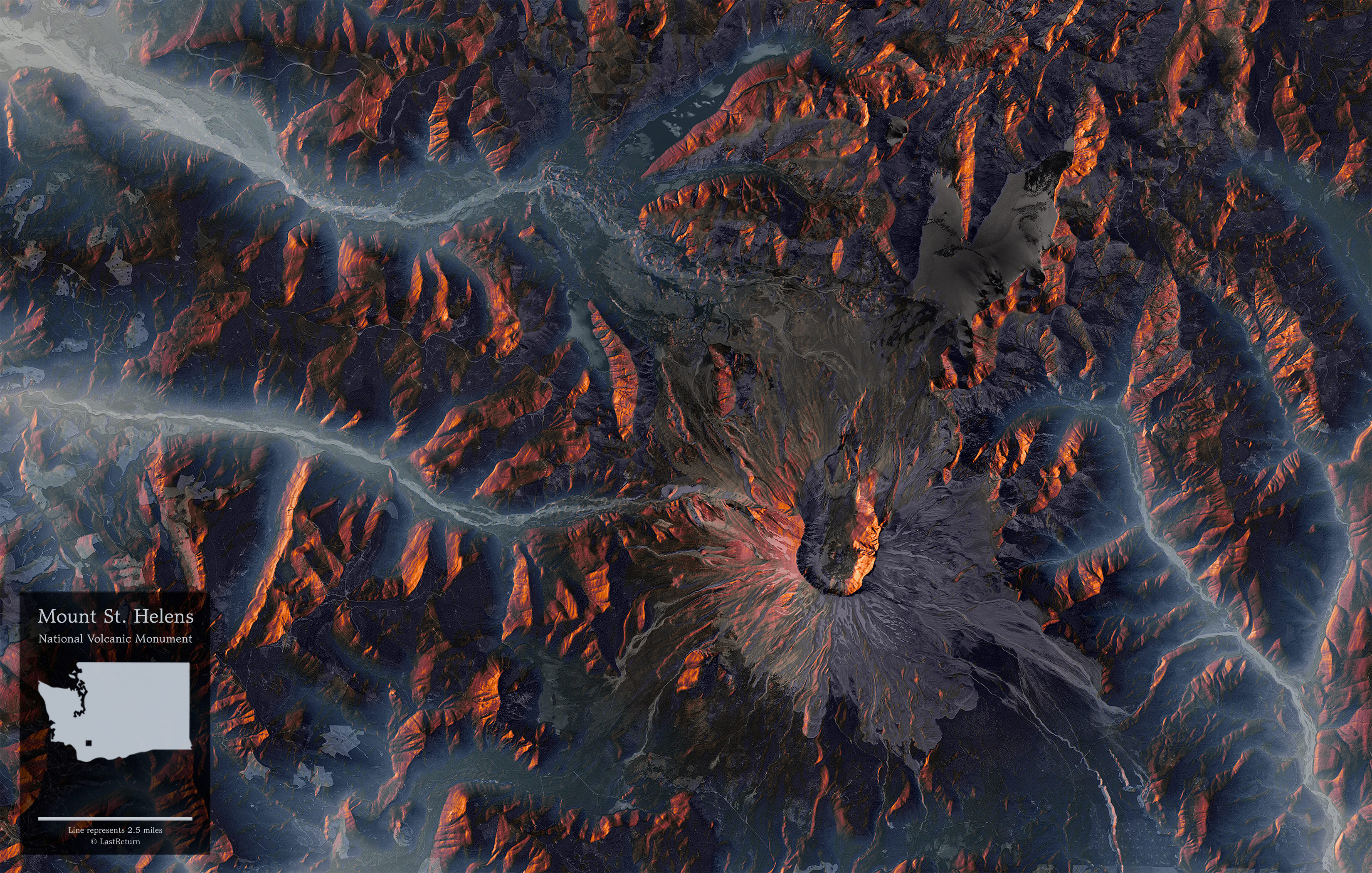
LiDAR DEM and hillshade. Created in ESRI ArcMap and Adobe Photoshop
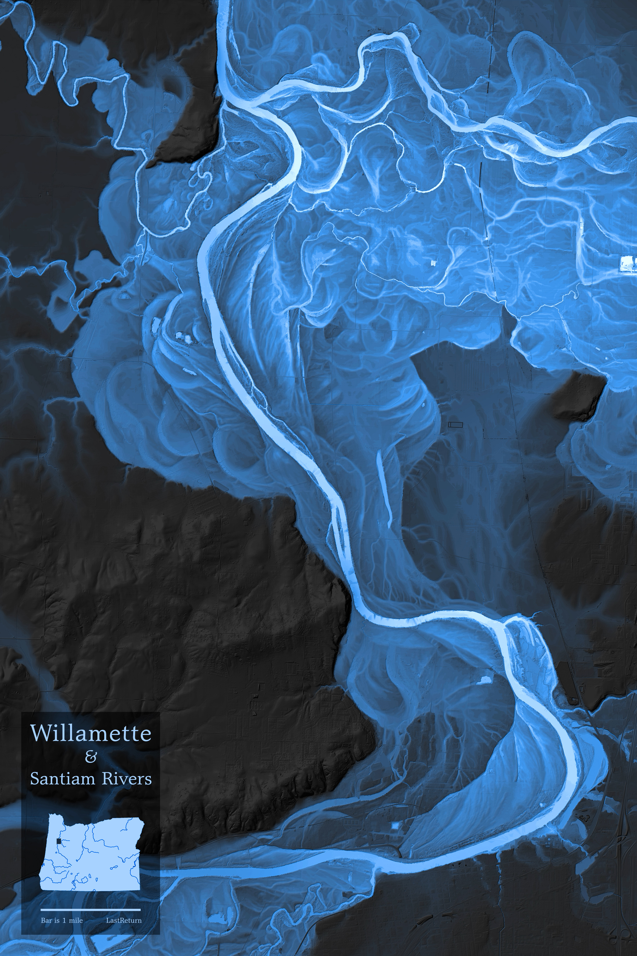
36″ x 48″ poster. Color theme based on Harold Fisk’s Mississippi River map series. Created in ESRI ArcMap
DEMs, hillshade, and aerial photos overlaid. Created in QGIS and Adobe Photoshop