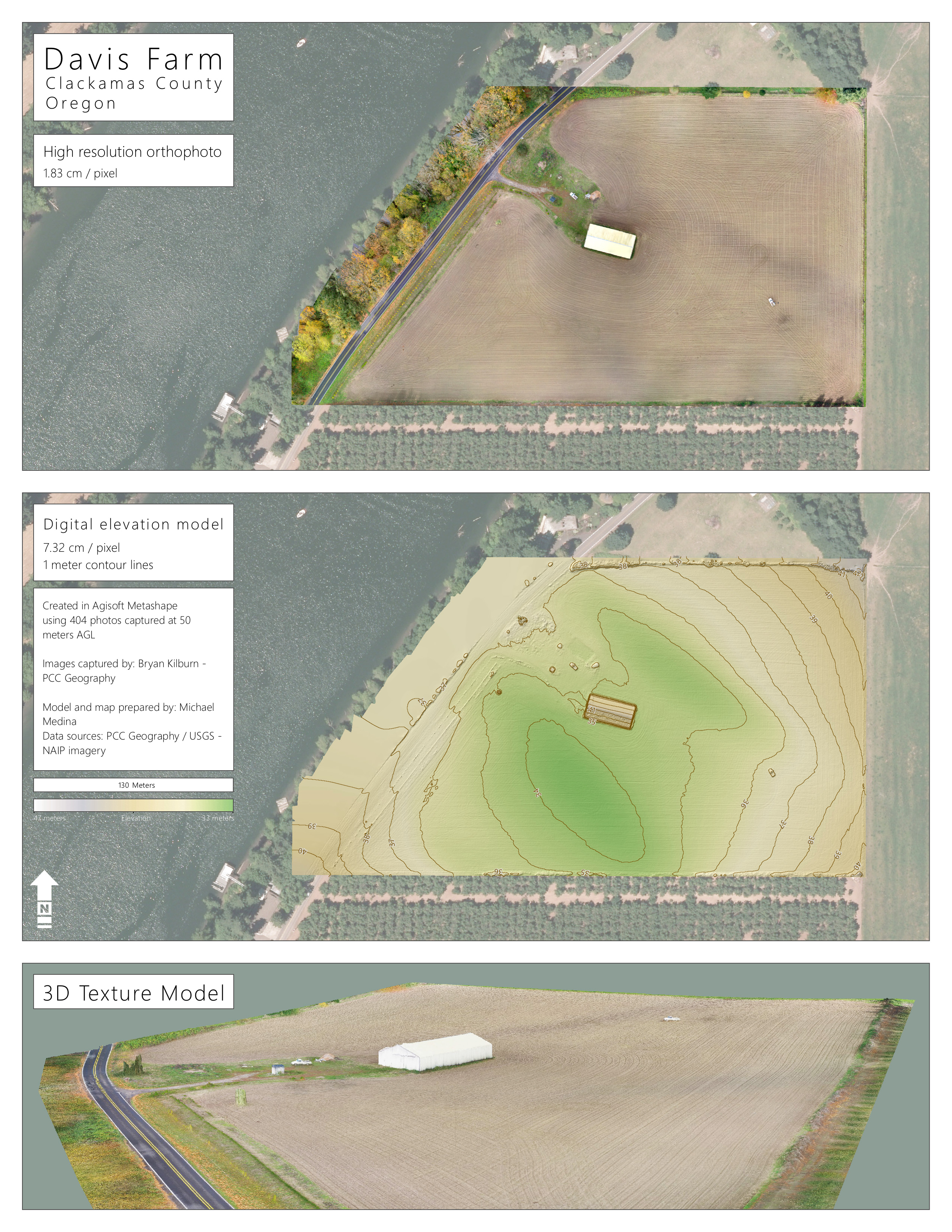
Captured with DJI Phantom 3 Professional – Created with Agisoft Metashape/PhotoScanPro and ESRI ArcMap
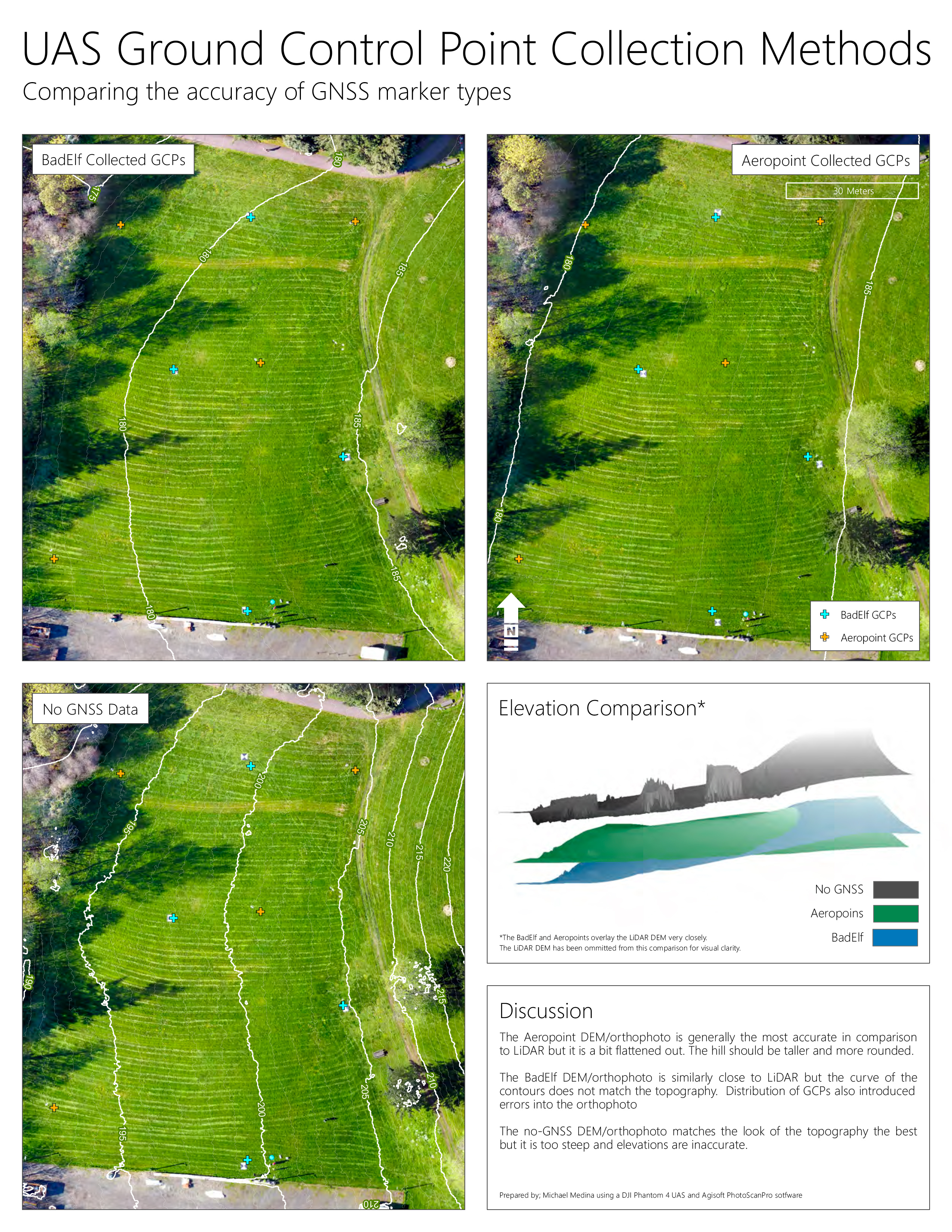
Captured with DJI Phantom 4 – Created with Agisoft Metashape/PhotoScanPro and ESRI ArcMap and ArcGIS Pro
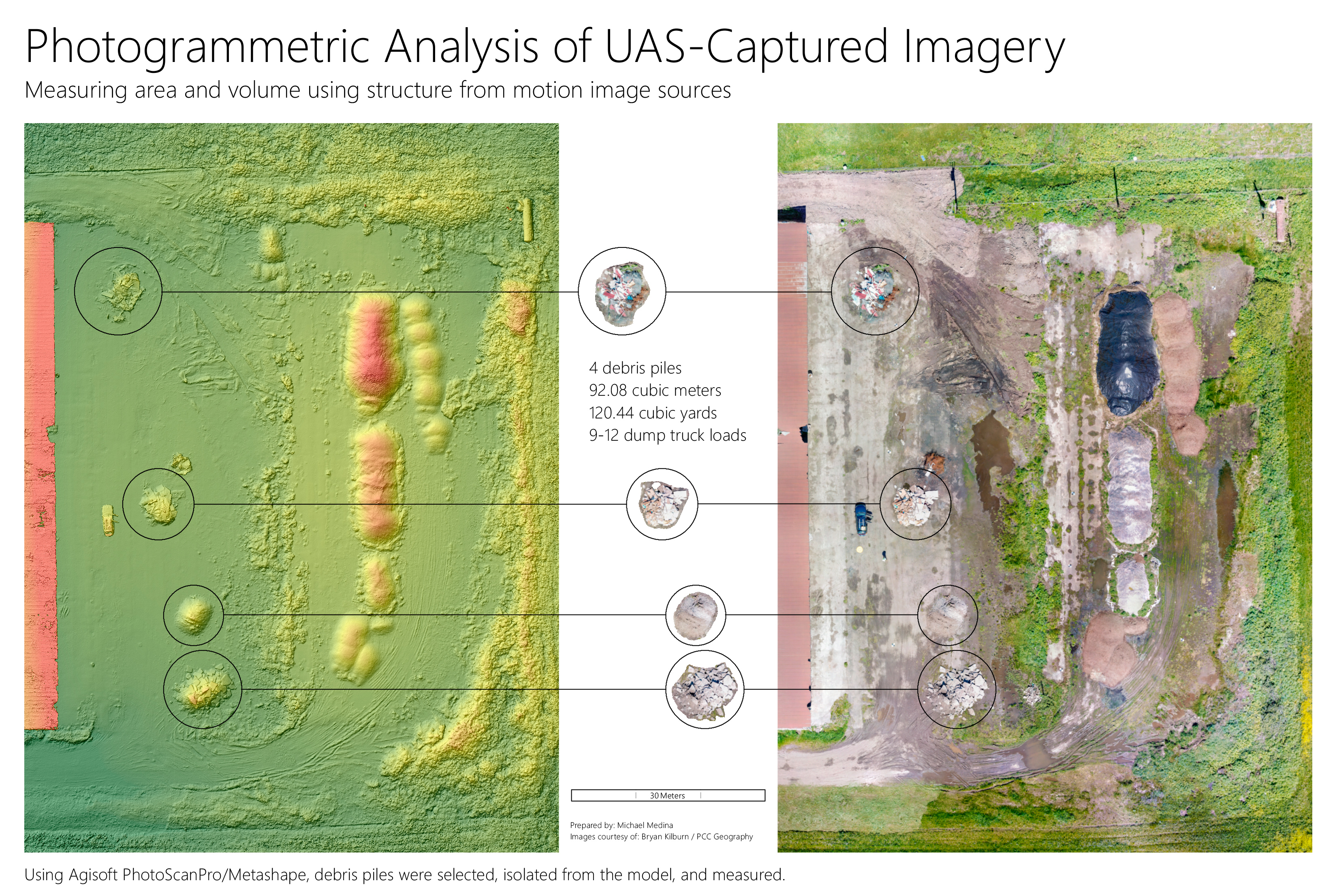
Captured with DJI Phantom 3 Professional – Created with Agisoft Metashape/PhotoScanPro and ESRI ArcMap